Ubajara
Ubajara

Crédit image:
licence CC BY 3.0 br 🛈
| Pays | |
|---|---|
| Unité fédérative | |
| Superficie |
421,04 km2 |
| Altitude |
847 m |
| Coordonnées |
3° 51′ 16″ S, 40° 55′ 16″ O |

Crédit image:
Raphael Lorenzeto de Abreu
licence CC BY 2.5 🛈
| Population |
32 767 hab. () |
|---|---|
| Densité |
77,8 hab./km2 () |
| Gentilé |
Ubajarense, ubajarense |
| Statut |
|---|
| Drapeau |
Flag of Ubajara () |
|---|---|
| Hymne |
Anthem of Ubajara () |
| Code postal |
62350-000 |
|---|---|
| Indicatif téléphonique |
88 |
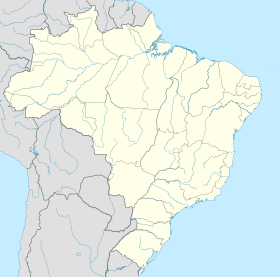
Localisation sur la carte du Brésil
 Crédit image: licence CC BY-SA 3.0 🛈 |
Ubajara est une municipalité brésilienne de l’État du Ceará. En 2010, elle compte 31 792 habitants.
Notes et références
Source
- (pt) Cet article est partiellement ou en totalité issu de l’article de Wikipédia en portugais intitulé « Ubajara » (voir la liste des auteurs).

