Prioro
Prioro

Crédit image:
licence CC BY-SA 3.0 🛈

Crédit image:
licence CC BY-SA 4.0 🛈
| Nom officiel |
(es) Prioro |
|---|
| Pays | |
|---|---|
| Communauté autonome | |
| Province | |
| Partie de |
Mancomunidad Montaña de Riaño () |
| Chef-lieu |
Prioro () |
| Superficie |
48,98 km2 |
| Altitude |
1 120 m |
| Coordonnées |
42° 53′ 39″ N, 4° 57′ 42″ O |

Crédit image:
- Leon_-_Mapa_municipal.svg: Tony Rotondas
- derivative work: Rodelar (talk)
licence CC BY-SA 3.0 🛈
| Population |
349 hab. () |
|---|---|
| Densité |
7,1 hab./km2 () |
| Statut | |
|---|---|
| Chef de l'exécutif |
Francisco Jose Escanciano Escanciano () |
| Contient les localités |
Prioro (), Tejerina (en) |
| Saint patron |
|---|
| Code postal |
24885 |
|---|---|
| INE |
24120 |
| Immatriculation |
LE |
| Site web |
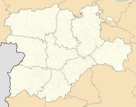
Géolocalisation sur la carte : Espagne
Géolocalisation sur la carte : Castille-et-León
 Crédit image:
licence CC BY-SA 3.0 🛈 |
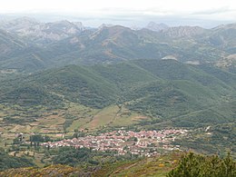
Prioro est une commune d'Espagne dans la province de León, communauté autonome de Castille-et-León. Elle s'étend sur 48,98 km2 et comptait environ 349 habitants en 2024[1]. Prioro comprend également le district de Tejerina .
Géographie
Prioro est situé à environ 58 km au nord-est de León à une altitude d'environ 1 120 m . La rivière Cea y prend sa source.
Évolution démographique
| Année | 1900 | 1950 | 1970 | 1981 | 1991 | 2001 | 2011 | 2021 | 2024 |
|---|---|---|---|---|---|---|---|---|---|
| Population | 1124 | 1371 | 937 | 668 | 574 | 441 | 407 | 338 | 349 |
| Source : INE[2]. | |||||||||
Sites touristiques
- Église Saint-Jacques de Prioro
- Chapelle du Christ
- La chapelle Marie.
-
 Crédit image:licence CC BY-SA 4.0 🛈Église Saint-Jacques.
Notes et références
- (de) Cet article est partiellement ou en totalité issu de l’article de Wikipédia en allemand intitulé « Prioro » (voir la liste des auteurs).
- ↑ (es) « Instituto Nacional de Estadística. (National Statistics Institute) », sur INE (consulté le ).
- ↑ « INEbase. Alteraciones de los municipios » (consulté le ).
Liens externes

