Liste des sites Ramsar en Iran
Cet article recense les zones humides d'Iran concernées par la convention de Ramsar.
Statistiques
La convention de Ramsar est entrée en vigueur en Iran le [1].
En , le pays compte 25 sites Ramsar, couvrant une superficie de 14 886,24 km2.
Liste
| Site | Province | Notes | Date | Superficie (km²) |
Altitude (m) |
Identifiant Ramsar |
Identifiant WDPA |
Coordonnées | Photo |
|---|---|---|---|---|---|---|---|---|---|
| Péninsule de Miankaleh , baie de Gorgan et Lapoo-Zaghmarz Ab-bandan | Mazandéran | 1 000,00 | 0 | 36 | 17152 | 36° 49′ 41″ nord, 53° 41′ 49″ est | |||
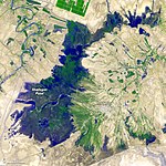
| Lac Parishan et Dasht-e Arzhan | Fars | 62,00 | 853 - 2 000 | 37 | 68012 | 29° 30′ nord, 52° 00′ est |  Crédit image:
Farid Atar licence CC BY 3.0 🛈 | ||
| Lac d'Ourmia | Azerbaïdjan occidental | 4 830,00 | 1 280 - 1 525 | 38 | 17154 | 37° 30′ nord, 45° 30′ est |  | ||
| Lacs de Neiriz et marais de Kamjan | Fars | 1 080,00 | 1 525 - 1 540 | 39 | 17155 | 29° 40′ 01″ nord, 53° 30′ 00″ est | |||
| Complexe de zone humide d'Anzali | Guilan | 150,00 | -23 | 40 | 17156 | 37° 25′ 01″ nord, 49° 28′ 01″ est |  Crédit image:
Karol Tofil licence CC BY 2.5 🛈 | ||
| Marais de Shadegan et vasières de Khor al Amaya et Khor Musa | Khouzistan | 4 000,00 | 0 - 15 | 41 | 17157 | 30° 30′ nord, 48° 45′ est |  | ||
| Hāmūn-e-Saberi et Hāmūn-e Helmand | Sistan-et-Baloutchistan | 500,00 | 470 - 475 | 42 | 17158 | 31° 14′ 10″ nord, 61° 15′ 14″ est | |||
| Lac Kobi | Azerbaïdjan oriental | 12,00 | 1 240 | 43 | 17159 | 36° 57′ nord, 45° 30′ est | |||
| Hamoun-e Puzak, extrémité sud | Sistan-et-Baloutchistan | 100,00 | 490 | 44 | 17160 | 31° 19′ 59″ nord, 61° 45′ 00″ est | |||
| Lacs de Shurgol, Yadegarlu et Dorgeh Sangi | Azerbaïdjan oriental | 25,00 | 1 290 | 45 | 17161 | 37° 00′ nord, 45° 30′ est | |||
| Parc national de Bujagh | Guilan | 31,77 | -21 | 46 | 17162 | 37° 25′ 01″ nord, 49° 28′ 59″ est | |||
| Lac Amirkelayeh | Guilan | 12,30 | -20 | 47 | 68013 | 37° 16′ 59″ nord, 50° 12′ 00″ est | |||
| Lac Gurigöl | Azerbaïdjan oriental | 1,20 | 1 897 - 1 950 | 48 | 68014 | 37° 55′ 01″ nord, 46° 42′ 00″ est |  Crédit image:
licence CC BY-SA 4.0 🛈 | ||
| Lacs Alagol, Ulmagol et Ajigol | Mazandéran | 14,00 | 5 | 49 | 17165 | 37° 21′ 00″ nord, 54° 34′ 59″ est | |||
| Détroit de Clarence | Hormozgan | 1 000,00 | 0 | 50 | 17166 | 26° 45′ 00″ nord, 55° 40′ 01″ est | |||
| Deltas de Rud-e-Shur, Rud-e-Shirin et Rud-e-Minab | Hormozgan | 450,00 | 0 | 51 | 17167 | 27° 05′ 31″ nord, 56° 45′ 18″ est | |||
| Deltas de Rud-e-Gaz et Rud-e-Hara | Hormozgan | 150,00 | 0 | 52 | 68015 | 26° 40′ 01″ nord, 57° 19′ 59″ est | |||
| Lac Gavkhouni et marais du bas Zayandeh Roud | Ispahan | 430,00 | 1 470 | 53 | 17169 | 32° 19′ 59″ nord, 52° 46′ 59″ est |  Crédit image:
licence CC BY-SA 3.0 🛈 | ||
| Baie de Govater et Hur-e-Bahu | Sistan-et-Baloutchistan | 750,00 | 0 - 50 | 1006 | 220059 | 25° 10′ 01″ nord, 61° 30′ 00″ est | |||
| Île de Shidvar | Hormozgan | 8,70 | 0 - 8 | 1015 | 220078 | 26° 48′ nord, 53° 24′ est |  Crédit image:
licence CC BY-SA 4.0 🛈 | ||
| Lagune de Gomishan | Golestan | 177,00 | -27 | 1109 | 900697 | 37° 11′ 46″ nord, 53° 58′ 59″ est | |||
| Fereydunkenar , Ezbaran et Sorkh Ruds Ab-Bandans | Mazandéran | 54,27 | -23 | 1308 | 902321 | 36° 40′ 05″ nord, 52° 31′ 52″ est | |||
| Zone humide de Choghakhor | Tchaharmahal-et-Bakhtiari | 16,87 | 2 100 | 1939 | 555542697 | 31° 55′ 01″ nord, 50° 54′ 00″ est |  Crédit image:
Farid Atar licence CC BY 3.0 🛈 | ||
| Zone humide de Kanibarazan | Azerbaïdjan occidental | 9,27 | 1 275 | 1940 | 555542698 | 36° 59′ 56″ nord, 45° 46′ 08″ est | |||
| Zarivar | Kurdistan | 21,8558 | 1 200 - 2 502 | 2369 | [1] | 35° 32′ 31″ nord, 46° 07′ 34″ est |  Crédit image:
licence CC BY-SA 2.5 🛈 |
Annexes
Références
- ↑ « Iran (République islamique d') », Convention de Ramsar
Articles connexes
- Convention de Ramsar
- Liste des zones humides d'importance internationale de la convention de Ramsar
- Environnement en Iran
Liens externes
- Pour l'ensemble des points mentionnés sur cette page : voir sur OpenStreetMap (aide), Bing Cartes (aide) ou télécharger au format KML (aide).
- « Liste des sites d'Iran », Service d'information sur les sites Ramsar
- (en) « Ramsar Sites - Iran (Islamic Republic Of) », Protected Planet


