Pernštejnské Jestřabí
| Pernštejnské Jestřabí | |
 Crédit image: I would appreciate being notified if you use my work outside Wikimedia.
Do not copy this image illegally by ignoring the terms of the license below, as it is not in the public domain. More of my work can be found in my personal gallery.licence CC BY-SA 4.0 🛈 Le clocher de Jilmoví. | |
 |
 |
| Administration | |
|---|---|
| Pays | |
| Région | |
| District | Brno-Campagne |
| Région historique | Moravie |
| Maire | Pavlína Martinková |
| Code postal | 592 61 |
| Démographie | |
| Population | 192 hab. (2020) |
| Densité | 26 hab./km2 |
| Géographie | |
| Coordonnées | 49° 24′ 24″ nord, 16° 19′ 32″ est |
| Altitude | 485 m |
| Superficie | 750 ha = 7,5 km2 |
| Localisation | |
| Liens | |
| Site web | www.pernstejnskejestrabi.cz |
Pernštejnské Jestřabí (en allemand : Jestrab bei Pernstein) est une commune du district de Brno-Campagne, dans la région de Moravie-du-Sud, en République tchèque. Sa population s'élevait à 192 habitants en 2020[1].
Géographie
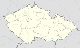
Pernštejnské Jestřabí se trouve à 32 km au nord-ouest de Brno et à 63 km au nord de Prague[2].
La commune est limitée par Olší au nord-ouest, par Doubravník au nord-est, par Borač et Kaly à l'est, par Horní Loučky au sud et par Skryje à l'ouest[3].
Histoire
La première mention écrite du village date de 1364.
Administration
La commune se compose de quatre quartiers :
- Husle
- Jilmoví
- Maňová
- Pernštejnské Jestřabí
Notes et références
- ↑ (cs) Population des communes de la République tchèque au 1er janvier 2020.
- ↑ Distances à vol d'oiseau ou distances orthodromiques.
- ↑ D'après geoportal.gov.cz.


